10 Years After
Tuesday, December 23, 2014
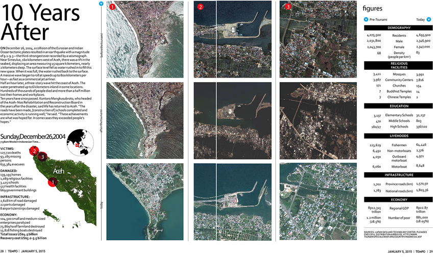
ON December 26, 2004, a collision of the Eurasian and Indian Ocean tectonic plates resulted in an earthquake with a magnitude of 9.1-9.3the third-strongest ever recorded by a seismograph. Near Simeulue, 160 kilometers west of Aceh, there was a rift in the seabed, displacing an area measuring 15 square kilometers, nearly 2 kilometers deep. The surface level fell as water rushed in to fill this new space. When it was full, the water rushed back to the surface. A massive wave began to roll at speeds up to 800 kilometers per houras fast as a commercial jet airliner.
arsip tempo : 174632615439.

ON December 26, 2004, a collision of the Eurasian and Indian Ocean tectonic plates resulted in an earthquake with a magnitude of 9.1-9.3the third-strongest ever recorded by a seismograph. Near Simeulue, 160 kilometers west of Aceh, there was a rift in the seabed, displacing an area measuring 15 square kilometers, nearly 2 kilometers deep. The surface level fell as water rushed in to fill this new space. When it was full, the water rushed back to
...
Subscribe to continue reading.
We craft news with stories.
 For the benefits of subscribing to Digital Tempo, See More


